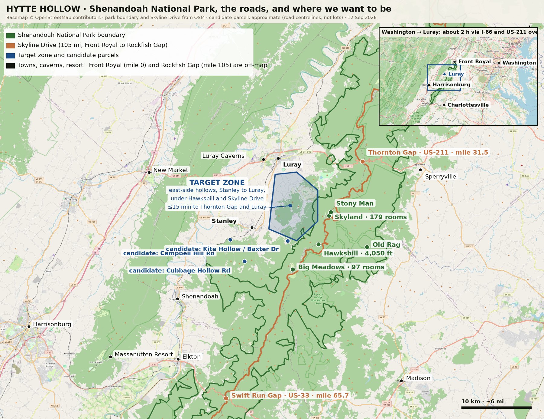
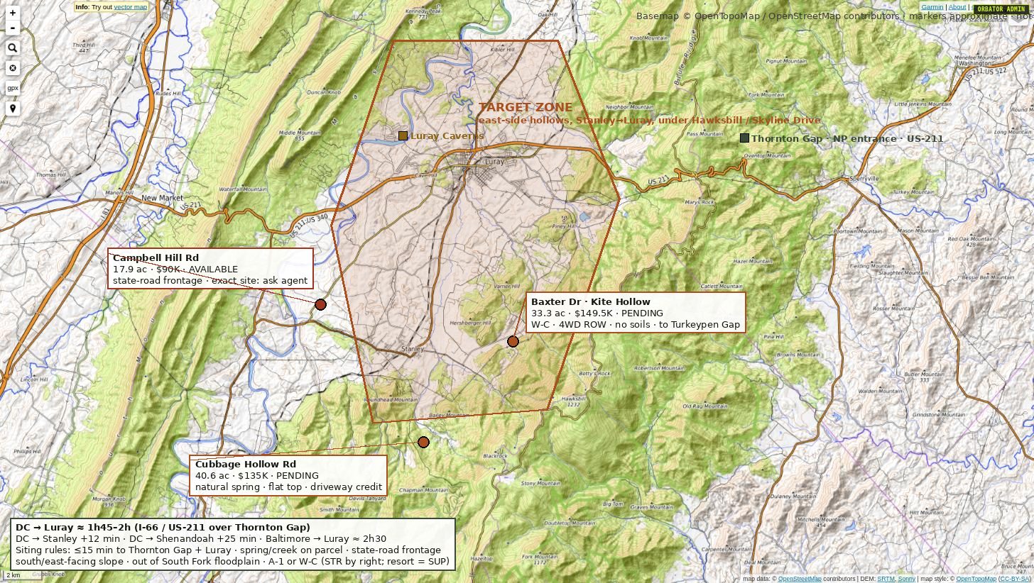
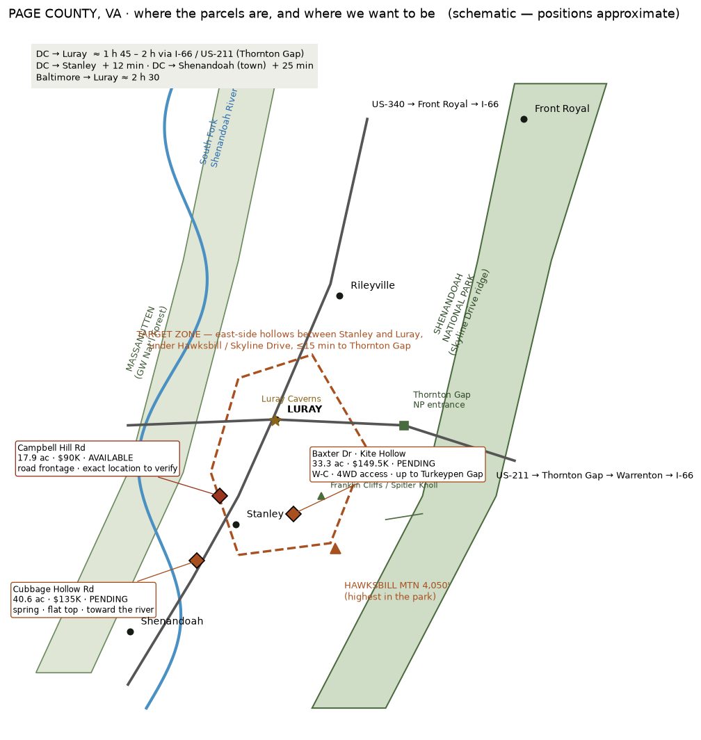
The cabins go in one of the wooded hollows between Stanley and Luray, on the east side of the Page Valley, under Hawksbill Mountain and Skyline Drive. Far enough in that you hear the creek at night. Close enough that you leave the office at five and are in the sauna by nine.
From Washington it is I-66 west to Gainesville, then US-211 over the Blue Ridge at Thornton Gap and down into Luray. The last mile is ours.
| From | Drive | Route |
|---|---|---|
| Washington, DC | about 2 h | I-66 → US-211 |
| Arlington / Tysons | about 2 h | I-66 → US-211 |
| Bethesda / Silver Spring | about 2 h 15 | I-495 → I-66 → US-211 |
| Dulles Airport | about 1 h 40 | US-50 or I-66 → US-211 |
| Baltimore | about 2 h 45 | I-95 → I-495 → I-66 → US-211 |
| Richmond | about 2 h 15 | I-64 → US-33 → US-340 |
| Charlottesville | about 1 h 15 | US-29 → US-33 → US-340 |
| Harrisonburg | about 45 min | US-33 → US-340 |
| Place | Drive | Why |
|---|---|---|
| Stanley | about 10 min | groceries, the hardware store, Pioneer Bank |
| Luray | about 15 min | restaurants, coffee, the county seat |
| Luray Caverns | about 15–20 min | 54°F underground all year; the rainy-day plan |
| Wisteria Farm & Vineyard | about 10–15 min | the local vineyard, between Luray and Stanley |
| Thornton Gap entrance, Skyline Drive | about 25 min | US-211; the central district of the park |
| Shenandoah River, South Fork | about 20–35 min | canoes, tubes and kayaks from the outfitters in Luray and Bentonville |
| Swift Run Gap entrance | about 35 min | US-33; the quieter way onto Skyline Drive |
| Big Meadows | about 40 min | the park's lodge, deer at dusk, Dark Hollow Falls |
| Massanutten ski slopes | about 40 min | the January plan, see winter |
| Hawksbill summit trailhead | about 45 min | Skyline Drive mile 45.6; the mountain above the cabins, 4,050 ft |
| Old Rag | about 1 h | the other side of the ridge; tickets required in season |
Page County calls itself the cabin capital of Virginia, and most of those cabins sit along the river or on the open valley floor. We wanted the other thing: the folds of wooded land that run up from Stanley and Luray to the park boundary, where the creeks start and the sightlines end.
The numbers behind the choice: Shenandoah National Park took 1.7 million visits in 2024, its highest in decades, and Thornton Gap above Luray is one of its two busiest entrances. Luray Caverns takes about half a million people a year. Lodging is 39% of Page County's visitor economy, the highest share of any county in the valley. People already come here to sleep; what is missing is the place we are building.
The rules we are buying by: fifteen minutes or less to the Thornton Gap entrance and to Luray; a state road at the gate, not a shared lane; soils that will carry nine cabins and a commons on their own well and septic; and no neighbour visible from a deck. The last one is why it is taking a while.
Redbud and dogwood in April, the falls running, the Skyline Drive reopening. Cool nights that make the sauna feel earned.
Warm, green, loud with insects at night. The river is the afternoon; the plunge is the evening.
The busiest six weeks in the park. Book early or come midweek. The colour on Hawksbill peaks mid to late October.
Quiet, clear, cold. Skyline Drive closes in ice and snow; the caverns and the sauna do not. Built for January →
The founding list gets the parcel, the site plan and the drone footage the day we close. One email.
No payment, no obligation. Nothing is for sale on this page.